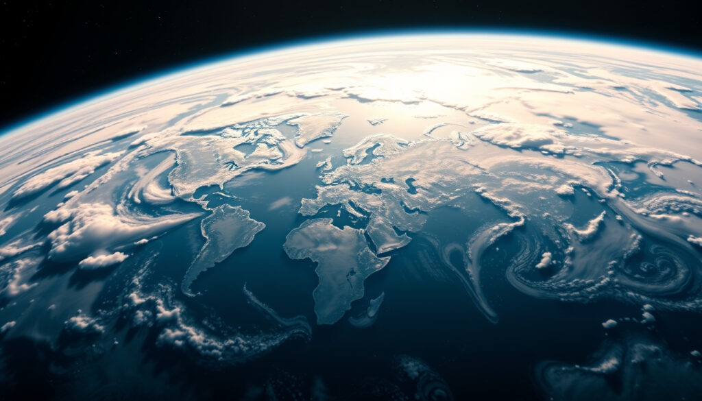
Continents of the World: 7 Continents List, Sizes & Facts
Most schoolrooms still display the same seven-colored map their parents memorized, yet the question of how many continents exist has quietly grown more complicated. Geologists now argue about Zealandia, a mostly underwater landmass larger than India, while geographers debate whether Oceania qualifies as a continent at all. If you ever relied on a mnemonic like “Mrs. GER” to remember the continents, you may be surprised to learn that the answer depends on who you ask — and what they mean by “continent.”
Number of continents: 7 · Largest continent by area: Asia (44.58 million km²) · Smallest continent by area: Australia (7.69 million km²) · Most populous continent: Asia (4.7 billion people) · Least populous continent: Antarctica (1,000–5,000 people)
Quick snapshot
- The 7-continent model appears in most English-speaking school systems (Wikipedia – Continent)
- Asia covers 44,614,000 km² — larger than the next two continents combined (Wikipedia – Continent)
- Australia at 7,617,930 km² is the world’s smallest continent, not an island (Wikipedia – Continent)
- Whether Oceania is a continent or a geographical region — definitions differ by country (Wikipedia – Continent)
- Full continental recognition of Zealandia — no international body formally validates new continents (Science News)
- In 2017, geologists from New Zealand, New Caledonia, and Australia formally proposed Zealandia as Earth’s eighth geological continent (GNS Science)
- A 2021 study found billion-year-old rocks beneath Zealandia, doubling the known age of its crust (Science Learning Hub)
- Geological consensus on Zealandia is building, but textbooks will likely lag for years
- The 7-continent model remains standard in most K–12 curricula globally
Below is a detailed breakdown of each continent’s land area and estimated 2025 population, drawn from the Worldometer dataset.
| Continent | Area (km²) | Population (2025) | Share of world population |
|---|---|---|---|
| Asia | 44,614,000 | 4,835,320,061 | 58.7% |
| Africa | 30,365,000 | 1,549,867,585 | 18.8% |
| North America | 21,329,947 | 617,286,638 | 7.5% |
| South America | 17,461,112 | 438,105,376 | 5.3% |
| Antarctica | 13,720,000 | 0 | 0% |
| Europe | 22,134,710 | 742,556,239 | 9.0% |
| Australia/Oceania | 8,486,460 | 46,609,644 | 0.6% |
Do we have 7 or 8 continents?
The answer depends entirely on which classification system you consult. Most English-speaking countries teach a 7-continent model in schools: Asia, Africa, North America, South America, Antarctica, Europe, and Australia (or Oceania). This system treats Europe and Asia as separate landmasses, which is a convention rooted in ancient Greek geography more than geology. The number shifts depending on where you grew up. Some countries merge Europe and Asia into a single landmass called Eurasia, which drops the total to six. Others, including many Spanish-speaking nations, combine the Americas into one, yielding a 5-continent model (Wikipedia – Continent).
Standard 7-continent model
Most English-speaking nations use this model as the foundation for K–12 geography curricula, treating Europe and Asia as distinct despite their physical connection.
- Five populated continents (Asia, Africa, Europe, North America, South America) plus Antarctica and Australia/Oceania
- Taught in the United States, United Kingdom, Canada, and most Commonwealth nations
- Europe and Asia treated as distinct despite sharing the same landmass
Variations including Europe-Asia as Eurasia
From a geologist’s perspective, Europe and Asia share a continuous continental shelf with no ocean separating them. The 6-continent model groups them as “Eurasia” and is common in Russia, parts of Eastern Europe, and Japan. Some geological models go further, combining Africa with Eurasia to form “Afro-Eurasia,” which would reduce the count to four major landmasses. These models are not competing guesses — they reflect different priorities between cultural tradition and physical geography.
“There is no geological basis for separating Europe from Asia — they share a continuous landmass, the same tectonic plate, and similar flora and fauna. The boundary was established by ancient Greek geographers who needed a way to organize their known world.”
The International Standards Organization (ISO) uses no standardized continent list, leaving the question deliberately unresolved.
The implication is that continental boundaries are cultural inventions layered onto a single continuous landmass, not natural divisions.
Is Oceania a continent?
This is where geography gets political. Oceania is not a continent in the same way Africa or Antarctica are — it is a geographical region defined by the Pacific Ocean and its islands. The landmass that makes up most of Oceania’s land area is Australia, which is genuinely a continent. But Australia alone is smaller than any other continent, leading some to argue that calling Australia a continent while grouping tiny Pacific islands with it under “Oceania” creates an inconsistency. In English-speaking countries, geographers and textbooks typically use Oceania to denote both Australia and the surrounding Pacific island nations. In most other languages and academic traditions, particularly in French, Spanish, and German, Australia itself is considered a continent (Wikipedia – Continent).
Geological vs. cultural definitions
- Geological definition: A continent is “one of Earth’s major landmasses, including both dry land and continental shelves” (Wikipedia – Continent)
- Cultural definition: A region defined by shared ocean, language families, and political associations
Australia vs. Oceania distinction
Australia is unambiguously a continent by area (7,617,930 km²) and by its distinct tectonic plate. Oceania as a region covers 8,510,926 km² and includes nations such as Fiji, Samoa, and Tonga, which sit on separate tectonic plates. The distinction matters for cartography, climate science, and geopolitics — but for most everyday purposes, “Australia and Oceania” are used interchangeably.
The island nation of New Zealand is not on the Australian continent at all — it sits on its own tectonic plate and is now understood to be part of a distinct landmass called Zealandia. What most people call “Australia” in casual conversation is technically just the continental landmass, while “Oceania” encompasses the broader Pacific region that includes it.
The pattern reveals that English-speaking conventions treat Oceania as a region while other academic traditions treat Australia as the continent — neither approach is wrong, just culturally conditioned.
Is Zealandia a continent?
In 2017, geologists from New Zealand, New Caledonia, and Australia published a landmark paper in GSA Today arguing that Zealandia — a vast landmass in the South Pacific — fulfills all geological requirements to be classified as Earth’s eighth continent. The paper, authored by researchers including Nick Mortimer and Hamish Campbell, pointed to a combination of geological markers: elevated continental crust, distinct rock compositions including granite (not basalt), and clear physical separation from Australia by oceanic crust (GNS Science). The case for Zealandia had been building since at least 2014, when Mortimer and Campbell published “Zealandia: Our Continent Revealed.”
“If it were not for the ocean level, Zealandia would have been recognised as a continent long ago.” — Nick Mortimer, geologist
Geological evidence
- Continental crust thickness measured between 10 km and 30 km, increasing to over 40 km beneath parts of New Zealand’s South Island (GNS Science)
- Geologists have identified granite, sedimentary basins, and volcanic activity consistent with continental geology
- Unlike ocean floor basalt, Zealandia’s rocks match the composition of other continental masses (Science News)
Mostly submerged landmass
Zealandia covers approximately 4.9 million square kilometres — roughly the size of the Indian subcontinent — yet 94% of it sits beneath the Pacific Ocean. Only New Caledonia, parts of New Zealand, and a handful of islands poke above sea level. A 2021 study found billion-year-old rocks beneath Fiordland and Stewart Island, doubling the previously known age of Zealandia’s crust and reinforcing its continental status (Science Learning Hub).
“There is now no doubt that Zealandia/Te Riu-a-Māui is a continent.” — Dr. Rose Turnbull, GNS Science
Recognizing Zealandia as a continent changes how geologists understand Earth’s tectonic history, continental drift models, and mineral resource distribution. For New Zealand and New Caledonia, continental status also carries geopolitical weight — UN conventions on extended continental shelves are tied to whether a territory sits on a continent.
The implication extends beyond geology: if Zealandia gains formal recognition, UN maritime boundaries for New Zealand and New Caledonia could expand dramatically along their continental shelves.
What continents no longer exist?
None of Earth’s continents have disappeared in the last 300 million years, but several ancient supercontinents have. The most famous is Pangaea, which began breaking apart around 200 million years ago and eventually formed the continents we recognize today. In the 4.5-billion-year history of Earth’s geology, entire landmasses have formed and fragmented in cycles. However, there are no verified extinct continents in modern geology — only landmasses that have broken apart and whose fragments now form the cores of current continents. Claims about “lost continents” like Atlantis belong to mythology, not scientific literature.
Myths about submerged lands
- Atlantis, described by Plato in 360 BCE, has never been located or geologically verified
- Legends of submerged civilizations (Mu, Lemuria) originated in 19th-century speculative fiction
- No credible geological evidence supports any claims of a historically inhabited, now-submerged continent
Ancient supercontinents in the geological record
Scientists have identified several supercontinents that predate the current arrangement: Rodinia (1.1 billion years ago), Pannotia (600 million years ago), and Pangaea (335–175 million years ago). These landmasses reformed and broke apart through multiple cycles. The current arrangement — the fragments of Pangaea drifting to their present positions — is temporary in geological terms. Within 250 million years, Earth’s landmasses may merge again into a new supercontinent.
Researchers at the University of Sydney and elsewhere use paleomagnetic data and tectonic modeling to reconstruct supercontinent cycles, published in journals including Nature and Earth-Science Reviews.
The catch: no “lost continents” in the Atlantis sense exist, but the current seven-continent arrangement is itself temporary — a snapshot in an endless cycle of assembly and breakup.
Which country falls under two continents?
Several countries straddle continental boundaries, but Russia’s situation is the most dramatic. The Ural Mountains, generally accepted as the boundary between Europe and Asia, run through western Russia. This makes Russia the largest country on Earth and the only one that occupies two continental landmasses. Russia’s territory spans roughly 17.1 million km², with the western portion (west of the Urals) considered part of Europe and the eastern portion part of Asia. In the United Nations classification, Russia is placed in the Europe category, but this is a convention rather than a geological fact (Worldometer). Turkey presents a similar case — Istanbul lies in Europe while the rest of the country sits in Asia, divided by the Bosphorus Strait.
Transcontinental countries list
- Russia: Europe and Asia, divided by the Ural Mountains
- Turkey: Europe and Asia, divided by the Bosphorus and Dardanelles straits
- Egypt: Africa and Asia, divided by the Sinai Peninsula
- Kazakhstan: Europe and Asia, with most territory in Asia but a small western portion west of the Ural River
- Azerbaijan and Georgia: Each has small portions north of the Caucasus watershed line considered European
Why continental boundaries are fuzzy
There is no geological basis for separating Europe from Asia — they share a continuous landmass, the same tectonic plate, and similar flora and fauna. The boundary was established by ancient Greek geographers who needed a way to organize their known world. Even the Ural Mountains, the most commonly cited divider, are not a sharp geological break. The Caucasus Mountains further east are sometimes used as the alternative boundary, which would shift Turkey, Azerbaijan, and Georgia entirely into Asia. These choices are cultural and historical, not scientific.
Continental boundaries are arbitrary lines drawn by ancient civilizations, not by plate tectonics. Russia “belongs” to both continents and neither — its identity is shaped more by politics and history than by anything a geologist would recognize as a meaningful division.
What this means for geopolitics is that Russia’s continental classification affects its seat at UN regional groups, which in turn influences voting blocs and diplomatic relationships across Europe and Asia.
Related reading: How Many Billionaires in the World? 3,428 in 2026 Forbes List · Best Places to See Penguins: Top 5 Worldwide Spots
Geological debates over Zealandia as a potential eighth continent parallel insights from the continents sizes and facts, which outlines the standard seven by size and key attributes.
Frequently asked questions
What are the 7 continents of the world?
The seven continents, in order from largest to smallest by area, are Asia, Africa, North America, South America, Antarctica, Europe, and Australia/Oceania. Asia covers approximately 44.6 million km² and Africa covers approximately 30.4 million km². Australia/Oceania is the smallest at approximately 8.5 million km².
What is the largest continent in the world?
Asia is the largest continent by both area (44,614,000 km²) and population (4.8 billion people as of 2025, representing approximately 58.7% of the world’s population). It is larger than Africa, the second-largest, by more than 14 million km².
What is the smallest continent in the world?
Australia (sometimes called Sahul) is the smallest continent by land area at 7,617,930 km². Despite its name, it is not an island — the distinction matters. Greenland, the largest island, covers only 2,166,086 km², less than a third of Australia’s size. Australia is large enough to have its own tectonic plate.
What are continents of the world by size?
The continents ranked by area are: (1) Asia at 44.6 million km², (2) Africa at 30.4 million km², (3) North America at 21.3 million km², (4) South America at 17.5 million km², (5) Antarctica at 13.7 million km², (6) Europe at 22.1 million km², and (7) Australia/Oceania at 8.5 million km². Total land area across all seven continents is approximately 148.9 million km².
How many continents and their countries?
The world has 195 recognized sovereign countries distributed across the seven continents. Asia has 48 countries, Africa has 54, Europe has 44, North America has 23, South America has 12, Oceania has 14, and Antarctica has no countries. The exact count varies slightly depending on disputed territories.
What is the rhyme to remember the seven continents?
Common mnemonics include “We Sailed Around North Friday, Crossing Europe And Asia” (WSANFCEA) or “We Sailed Around The North Sea, Exploring A Great Sea” (WSATNSEAGS). Many schoolchildren learn the simpler “Mrs. GER” (Africa, North America, South America, Europe, Australia, Antarctica, Asia — though this excludes Oceania).
Why do we have 7 continents instead of 5?
The 7-continent model emerged from traditions established by European geographers, particularly in the 17th and 18th centuries, when distinguishing Europe from Asia was culturally significant. The 5-continent model (Africa, America, Asia, Europe, Oceania) groups North and South America together and is common in Romance-language-speaking countries and in Olympic symbolism. The choice reflects history and convention, not an objective geological reality.
The 7-continent model isn’t wrong — it is a useful convention that happens to match what most people learned in school and what most world maps display. But it is a simplification built on centuries-old cultural choices rather than geological fact. Zealandia’s emergence as a potential eighth continent and the Oceania-versus-Australia debate show that Earth’s landmasses do not fit neatly into any single framework. For most practical purposes — navigation, education, geopolitics — seven works. For understanding the planet’s actual structure, geologists need a more nuanced map.
More related posts
 Jennette McCurdy 2026: Book, Ariana Grande, Sobriety Update
 Dee Salmin: Podcaster, Author, and ‘Boy Sober’ Voice
 Rayan Cherki: Parents, Religion, Height, and Career Facts
 Tim Wilson: Politician, Comedian, Academic – Who’s Who
 The Last of Us TV Show: Season 2, Joel’s Death & Future
 Bodhi & Ride for Beginners: Cost, What to Wear & Health Tips
 William the Conqueror: Life, Reign, and Legacy of England’s Norman King
 Josh Radnor: Biography, Wife, Net Worth, and Life After HIMYM
