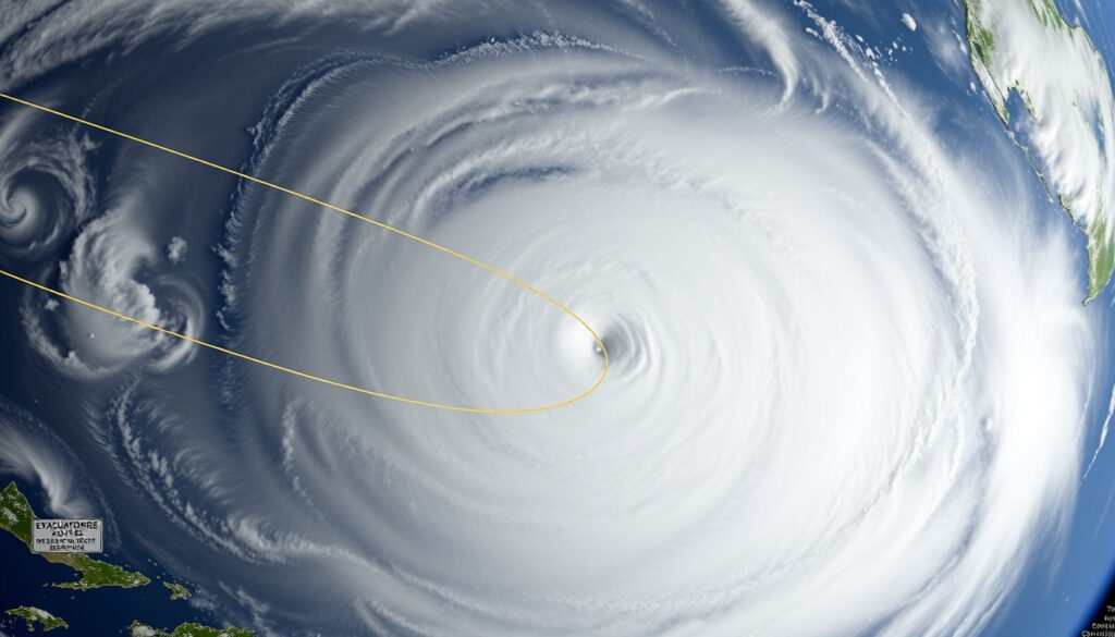
Cyclone Alfred Forecast: Path, Category and Safety
Most Australians associate cyclone season with the summer holidays, but Tropical Cyclone Alfred arrived like an uninvited guest in early March, catching many off guard along the east coast. This article tracks Alfred’s rare late-summer path, its impacts from Queensland to New South Wales, and what the storm reveals about the region’s vulnerability.
Peak wind speed: 165 km/h (Category 4) ·
Date formed: 21 February 2025 ·
Date dissipated: 9 March 2025 ·
Expected landfall area: East coast of Australia (Queensland/New South Wales) ·
10-minute mean winds: 85–100 km/h
Quick snapshot
- Current position and movement (Bureau of Meteorology)
- Expected landfall time: 8–9 March 2025 (Bureau of Meteorology)
- Wind speeds up to 165 km/h peak (Bureau of Meteorology)
- Safest room: small interior room without windows
- Emergency kit: food, water, torches, radios, medication
- Stay inside; avoid driving through floodwaters
- First cyclone to hit Brisbane since 1974 (Guy Carpenter)
- Australia has had multiple Category 5 cyclones (Guy Carpenter)
- Alfred reached Category 4, not 5 (Guy Carpenter)
Six key facts at a glance, from formation to dissipation:
| Fact | Value |
|---|---|
| Formed | 21 February 2025 |
| Dissipated | 9 March 2025 |
| Peak category | Category 4 (severe tropical cyclone) |
| Max sustained winds | 165 km/h (10-minute mean: 85–100 km/h) |
| Landfall area | Eastern coast of Australia (Queensland/New South Wales border region) |
| Fatalities | Not yet reported (as of early March 2025) |
Where is Cyclone Alfred going to hit?
Current forecast track
- Alfred crossed Bribie Island at 8:00 pm AEST on 8 March 2025, then moved west onto the mainland at 9:00 pm AEST, according to the Bureau of Meteorology (Australia’s national weather authority).
- Landfall occurred near Bribie Island, roughly 50 km north of Brisbane, as reported by Guy Carpenter (global risk advisory firm).
- Wind gusts along the southeast Queensland coast exceeded 80 km/h, with Brisbane and the Gold Coast recording gusts above 100 km/h (Guy Carpenter).
- Alfred dissipated by the morning of 10 March 2025.
Factors influencing Alfred’s movement
- After forming northeast of Cooktown, Alfred intensified over warm ocean waters and turned abruptly on 4 March 2025, heading toward the east coast.
- The steering flow — driven by a mid-level ridge — pushed Alfred southward before the sudden turn eastward.
- Ahead of landfall, Alfred was downgraded to a tropical storm (rain depression), but still brought heavy rainfall and flooding.
What this means: Alfred made history as the first tropical cyclone to make landfall directly near Brisbane since 1974, a recurrence interval that underscores how rare such storms are for the state capital. For residents in southeast Queensland and northeast New South Wales, the track was a catch: it took days to confirm it would actually hit, leaving short windows for last-minute preparation.
What caused Cyclone Alfred?
Meteorological conditions leading to formation
- Severe Tropical Cyclone Alfred (22U) formed as a tropical low northeast of Cooktown on 21 February 2025 (Bureau of Meteorology).
- The BoM named it Tropical Cyclone Alfred at 10:00 am AEST on 23 February 2025 while it was about 320 km northeast of Willis Island.
- It was initially classified as a subtropical system before deepening into a tropical cyclone.
- Alfred was the sixth named tropical cyclone of the 2024/25 Australian region cyclone season and the second to make landfall (Guy Carpenter).
Why a subtropical cyclone formed late in the season
- Late-summer sea surface temperatures remained above average in the Coral Sea, providing sufficient energy for cyclogenesis outside the typical peak (December–February).
- Weak wind shear and ample moisture allowed the system to develop slowly over warm waters north of Queensland.
- Alfred turned south overnight on 24 February 2025 and continued to intensify, reaching Category 4 status.
Why this matters: The late-season formation hints at a shifting pattern: warmer oceans are extending the window for tropical cyclone development, meaning systems like Alfred — which historically arrived only in summer — could become more common in early autumn. For emergency planners, this shortens the post-summer recovery window.
Has Australia ever had a cat 5 cyclone?
List of Australian region Category 5 severe tropical cyclones
- Australia has experienced multiple Category 5 severe tropical cyclones, including Cyclone Mahina (1899), Cyclone Tracy (1974 — though Category 4 at landfall), Cyclone Yasi (2011), and Cyclone Marcus (2018).
- Cyclone Mahina (1899) is the deadliest in Australian history, with over 400 deaths, according to historical records.
- Cyclone Yasi (2011) was a Category 5 system that devastated parts of Queensland with estimated damage exceeding $1.2 billion.
- Alfred peaked at Category 4, not Category 5, with maximum sustained winds of 165 km/h.
How Cyclone Alfred compares to past storms
Three comparisons, one clear pattern:
| Cyclone | Year | Peak category | Landfall location | Key impact |
|---|---|---|---|---|
| Mahina | 1899 | Category 5 | Queensland (Bathurst Bay) | Over 400 deaths, storm surge up to 13 m |
| Yasi | 2011 | Category 5 | Queensland (Mission Beach) | $1.2+ billion damage, widespread flooding |
| Alfred | 2025 | Category 4 | Queensland (Bribie Island, near Brisbane) | Flooding, coastal erosion, gusts >100 km/h |
The pattern: While Alfred was weaker than Mahina and Yasi at peak intensity, its location was more dangerous. Hitting Brisbane directly — a metropolitan area of over 2.5 million people — means the exposure footprint was much larger than most previous Category 5 storms that struck sparsely populated coastal regions. The trade-off: lower wind speeds but higher population density flooding risk.
Where is the safest place to be in a cyclone?
Indoor safety during a cyclone
- The safest place is a small interior room without windows on the lowest floor, such as a bathroom, pantry, or hallway (NSW State Emergency Service).
- Avoid using electrical appliances during the storm — lightning strikes and power surges can cause electrocution.
- Stay away from doors and windows; flying debris is the leading cause of injury.
- Listen to battery-powered radios for official updates.
Outdoor precautions and evacuation zones
- If caught outside, find solid shelter away from trees, power lines, and waterways.
- Do not drive through floodwaters — just 15 cm of moving water can knock a person over, and 60 cm will float most vehicles.
- Evacuation zones in coastal areas are mapped by local councils; the SES advises knowing your zone before a storm hits.
- Emergency kits should include bottled water (3 L per person per day for 3 days), non-perishable food, torches, batteries, a first-aid kit, medications, and important documents in waterproof bags.
For residents in southeast Queensland, the safest room during Cyclone Alfred might not be the strongest room — many older homes lack dedicated cyclone shelters. The real risk is not the wind but the floodwater: Alfred dropped 400–600 mm of rain in Brisbane and the Gold Coast in just a week, with some suburbs exceeding 800 mm (Guy Carpenter). That’s about two months of average precipitation in under 24 hours.
The implication: Wind is scary, but water kills. In Alfred’s case, the biggest threat was not the 100 km/h gusts but the flood risk. For anyone in a low-lying or flood-prone area, evacuation before the storm — not sheltering in place — was the correct choice.
What country is the most cyclone prone in the world?
Countries most exposed to tropical cyclones
- According to the World Risk Report 2024, the Philippines is the most disaster-prone country globally, facing frequent typhoons, earthquakes, and volcanic activity.
- China, Japan, the United States, and Bangladesh also face high cyclone risks due to long coastlines and exposure to the Pacific and Atlantic basins.
- Australia’s east coast is vulnerable but less exposed than the Philippines — the Philippines averages about 20 typhoons per year, whereas Australia sees roughly 11–12 tropical cyclones annually, with 4–5 crossing the coast.
Why the Philippines ranks highest
- The Philippines sits in the western Pacific typhoon belt, the most active tropical cyclone basin on Earth.
- Its geography — a long archipelago with coastal communities — amplifies exposure.
- High population density in coastal areas and limited infrastructure in some regions increase vulnerability.
What this means: While Australia rarely sees cyclones hit major cities (Alfred was the first near Brisbane in 51 years), the Philippines faces them as a routine fact of life. The same ocean warming that extended Alfred’s season affects both nations. For Australian residents, the lesson is not about frequency but about preparation for rare, high-impact events.
Timeline of Cyclone Alfred
- 21 February 2025 – Alfred formed as a tropical low northeast of Cooktown (Bureau of Meteorology)
- 23 February 2025 – Named by BoM at 10:00 am AEST, 320 km northeast of Willis Island (Bureau of Meteorology)
- 24 February 2025 – Turned south and began intensifying (Bureau of Meteorology)
- 4 March 2025 – Turned abruptly eastward, heading for the Queensland coast (Bureau of Meteorology)
- 7 March 2025 – Downgraded to a tropical storm ahead of landfall (Bureau of Meteorology)
- 8 March 2025 – Crossed Bribie Island at 8:00 pm AEST; made mainland landfall at 9:00 pm AEST (Bureau of Meteorology)
- 9 March 2025 – Severe flash flooding extended from Hervey Bay south to northeastern NSW (Bureau of Meteorology)
- 10 March 2025 – Dissipated by morning (Guy Carpenter)
The 4 March turn was the critical moment: it transformed Alfred from a fish storm — one that stays at sea — into a direct threat to millions of Australians. For forecasters, the late decision meant that evacuation orders and emergency announcements had to be compressed into a few days, a stress test for the region’s communication systems.
The compressed timeline between the turn and landfall tested the region’s emergency response systems.
Confirmed facts and what’s still unclear
Confirmed facts
- Alfred formed on 21 February 2025 as a tropical low northeast of Cooktown (Bureau of Meteorology).
- Peak intensity reached Category 4 with winds of 165 km/h (Bureau of Meteorology).
- Alfred turned eastward on 4 March 2025 (Bureau of Meteorology).
- Landfall occurred near Bribie Island, north of Brisbane, on 8 March 2025 (Bureau of Meteorology).
- Widespread flooding and coastal erosion were recorded across SE Queensland and NE NSW (Guy Carpenter).
- Significant wave heights of 5–8 metres were measured south of Brisbane (Bureau of Meteorology).
- Sand escarpments up to 6 metres high were left on some beaches (Bureau of Meteorology).
What’s unclear
- Exact landfall timing and location were subject to forecast changes up to 48 hours before impact.
- Potential rainfall totals and flood risk for many catchments remain uncertain until river gauges are fully analyzed.
- Long-term damage assessment — including insurance losses and infrastructure repair costs — is not yet available.
- The full extent of coastal erosion and recovery timeline for affected beaches is still being assessed.
“Millions of cubic metres of sand were scoured from beaches, leaving escarpments up to 6 metres high in some dunes during the prolonged event.”
— Bureau of Meteorology
“The rainfall in Brisbane in under 24 hours was about two months’ worth of average precipitation.”
— Guy Carpenter (global risk advisory firm)
Cyclone Alfred will be studied for years as a case study in late-season cyclone behavior and urban risk communication. For Australia’s east coast residents, the storm is a clear signal: the season is shifting, and preparation plans need to account for cyclones arriving well outside the traditional December–February window. For Brisbane, which had not seen a direct cyclone landfall since 1974, the message is blunt — the city’s infrastructure, from drainage systems to emergency services, was tested, and some parts passed while others struggled. The consequence for Queensland and northern NSW: invest in flood resilience and evacuation planning, or face a larger bill next time.
Related reading: BOM Brisbane Forecast
For real-time updates, check the latest Cyclone Alfred forecast and track from Auckland Review.
Frequently asked questions
How fast is Cyclone Alfred moving?
Alfred’s forward speed varied. After the abrupt turn on 4 March 2025, it moved at roughly 10–15 km/h toward the coast, slowing as it approached landfall. At its peak intensity, the system’s forward motion was around 12–18 km/h.
What areas should evacuate?
Evacuation zones were issued by local councils and the NSW State Emergency Service for low-lying coastal areas, flood-prone suburbs, and communities near rivers. Specific zones included parts of the Gold Coast, Brisbane’s bayside suburbs, and northern NSW coastal towns. Residents were advised to check their local council’s disaster dashboard.
Is Cyclone Alfred dangerous?
Yes. Although downgraded to a tropical storm before landfall, Alfred brought damaging wind gusts (over 100 km/h in Brisbane and the Gold Coast), heavy rainfall (400–600 mm in a week), life-threatening flash flooding, and coastal erosion that scoured millions of cubic metres of sand from beaches. Flooding was the primary danger.
How does Cyclone Alfred compare to Cyclone Debbie?
Cyclone Debbie (2017) was a Category 4 system that made landfall in northern Queensland near Airlie Beach, causing an estimated $2.6 billion in damage. Alfred (Category 4 at peak) made landfall near Brisbane — a much more densely populated area. Debbie was stronger in sustained winds (175 km/h vs Alfred’s 165 km/h), but Alfred produced comparable rainfall totals and broader flood impacts due to its slower movement.
When will Cyclone Alfred dissipate?
Alfred dissipated by the morning of 10 March 2025, according to Guy Carpenter.
More related posts
 Telstra Prepaid Recharge – Complete Top-Up Guide
 Sausage Dogs in Ireland: Dachshund Guide on Care & Costs
 Nancy Wheeler: Age, Relationships and Real-Life Romance
 Christ Redeemer: History, Facts, and Wonders
 James Johnston: Australian Country Singer Biography & Songs
 China Post Tracking: How to Track, Real Numbers, Delivery Times
 Nancy Cartwright: Voice of Bart Simpson, Net Worth, Religion & More
 Sheryl Crow: Biography, Illness, Relationships, and Net Worth
